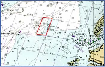
Anglers Reef is located 2.5 nautical miles WNW of the entrance to Onancock Creek. The shape of the site is a parallelogram with the perimeter defined by loran lines.
Four deployments, 450 tons each, of concrete pipe are located at the NW, NE, SW, and SE quadrants approximately 200 feet from the yellow VMRC buoy designated "A", that marks the center of the reef.
More than 1600 concrete tetrahedrons are deployed in a circular pattern approximately 600 ft. wide 600 feet NW of the buoy, and a 35 ft. x 90 ft. barge is to the northeast.
In 2006, 2000 tons of cylinder pile, block and bridge sections, donated by Bayshore Concrete Products, Inc., were deployed to the SE. This deployment was paid for with Saltwater Fishing License revenue. Actual reef site is northeast of the charted fish haven area.
